
Fitopoly
What If Your Next Walk Could Take Over the Map?
Fitopoly turns walks, runs, hikes, and bike rides into a real-world strategy game where every route can capture territory.

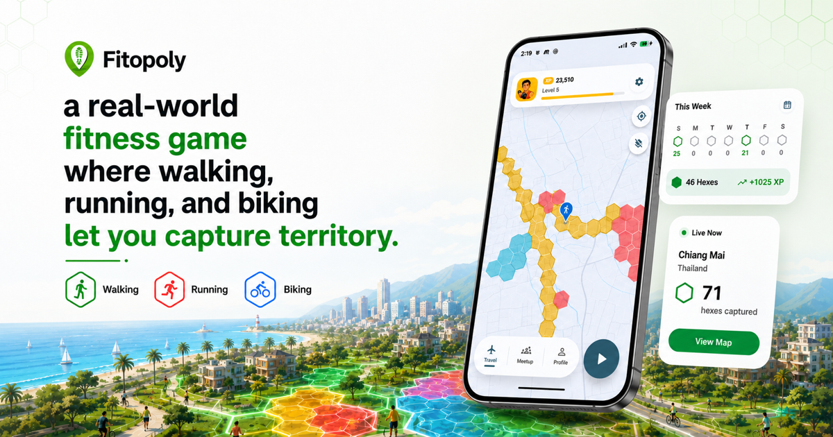
Fitopoly started with a simple thought I had while spending September in La Jolla: what if exploring a place could feel like playing a game?
La Jolla is the kind of place that makes you want to keep moving. One path leads to the ocean, another climbs toward a view, and a quick walk can easily turn into an afternoon of wandering. I began imagining a game that could make that sense of discovery visible—something that would remember where you had been while giving you a reason to see what was around the next corner.
That idea became Fitopoly.
Its main feature is simple: move through the real world and capture territory on the map.
The map is divided into hexagons. As you walk, run, hike, or ride your bike, you capture those hexes for your team. Your movement changes the map, turning an ordinary workout or afternoon stroll into a strategy game.
You can keep things casual and see how much ground you cover, or get more tactical. Connect your route into a loop and you can claim a much larger area. Capture neighboring hexes to build stronger territory. Earn XP, climb the rankings, compete with other players, and watch the map evolve as people explore and recapture different places.
The fun part is that there isn’t one “correct” way to play.
If you’re using Fitopoly for fitness, it gives you an extra reason to get outside. “I should go for a walk” becomes “I wonder if I can capture those five hexes before dinner.” A familiar running route can become a mission, and taking the slightly longer way home suddenly feels completely reasonable.
If competition is your thing, there are teams, leaderboards, scheduled competitions, private events, and a Global Weekly Competition. You can chase XP, challenge friends, protect your territory, or simply enjoy seeing your color spread across the map.
If you love to travel, Fitopoly becomes a living record of the places you’ve explored. Your Travel map highlights visited countries and organizes your history by location and date. Instead of another folder full of photos you may never open, you get a map shaped by where your own feet—or bicycle wheels—have taken you.
And if you’re a record-keeping person, Fitopoly remembers your captures, activities, XP, strongest days, completed sessions, and the larger territories you create. It’s part game board, part fitness log, and part personal travel atlas.
There’s even offline play for those moments when the best places to explore are the ones with the worst reception.
That multi-use nature is what excites me most. One person might open Fitopoly because they want motivation to exercise. Another might want to beat a friend on the leaderboard. Someone else may simply enjoy filling in the map whenever they visit a new city.
All three are playing the same game—just for completely different reasons.
Fitopoly began with a September in La Jolla, but the goal is much bigger: to make wherever you are feel a little more open, playful, and worth exploring.
I’d love for you to try it. Take Fitopoly on a walk, run, bike ride, or your next trip. Capture a few hexes. Close a loop if you’re feeling ambitious. Then let me know what you think.
What was fun? What was confusing? What made you want to keep moving—and what would make you come back?
Your feedback will help shape where Fitopoly goes next.